- Date:
2021-11-18 - 2021-11-19
This hike was sandwiched between several busy weekends (Eric and Amanda Lewis's Wedding, Bulldog 93.3 Party, Thanksgiving), so it was the perfect time to escape for a hike in the woods.
This section of The Appalachian Trail is one that I do not recall having hiked in the past, and it is one of the more hilly hikes in recent memory.
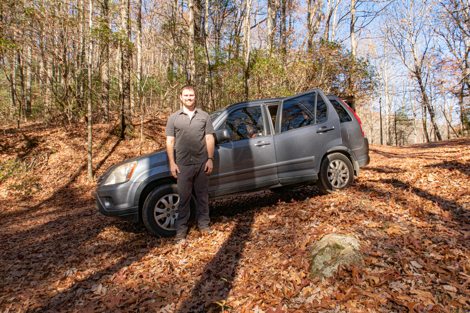
Starting on Thursday morning at 9:00AM, Millie, Mabel, and I left the car at Blue Ridge Gap and started traveling South toward Tray Mountain for an out-and-back trip. I brought the Kenwood TH-K2 2-meter portable radio programmed with local repeaters in the memory channels and 3 fully charged batteries for plenty of talk time.

This photo was shot while parked on the side of Charles Creek Road at Blue Ridge Gap just before embarking. I enjoyed a seltzer water on the drive up, and I was communicating with David, N4TS, in his repeater as shown on the mobile radio display.

I am one of the N4TS 2m repeater fanboys. The mobile radio is the Icom IC-V8000 75W 2m rig I bought at the Stone Mountain Hamfest two weeks prior for $75. The entire interior of the vehicle always looks like a dog fur bomb exploded despite how many times I clean it.

This sign was near my starting point.


I monitored the ham radio the entire trip. The N4TS repeater was usable sporadically, but I ultimately discovered that the W4LSG repeater on Ivy Mountain in Clarkesville was more reliable on this section of trail. Once I determined this, my ham radio friends (David, Clayton, Woody, and Heath) made the switch with me for the duration of the hike.

Cowart Gap is a midway point along the path. The hike on Saturday was strenuous, but I ad a good time.


Dicks Creek Gap

Georgia Hwy 76 at Dicks Creek Gap. We drove past this crossing en route to the trailhead.

Looking the other direction. This is the division of Rabun and Towns Counties in Georgia.

A water spring along crossing the path


I passed by a fellow hiker named Mike who I ended up talking with for an hour. It was around that time I determined that it would not be possible to reach Tray Mountain before dark. To complicate matters, at around 2:30 the "40% chance" of rain started. I made it to a shelter at Deep gap at around 3:30 as the rain was stopping, but I was tired so I decided to camp there.

And what a nice shelter - a 2-level accommodation built in 1991 with benches and a standing table. Fortunately there were no other campers present, but there were several abandoned sleeping bags on the top level of the shelter that the dogs enjoyed using during the sub-32°F night.


I spent time gathering a 3 or 4 handfuls of fire wood but was unable to ignite the semi-dry leaves. Next time I will be better prepared.
I set up the rollup J-Pole antenna that David gave me and then prepared a freeze dried Mountain House dinner. Despite not being at the top of a mountain I was able to communicate with several ham radio buddies on Joey's W4LSG repeater on Ivy Mountain in Clarkesville. That machine has excellent coverage on this section of the trail.
Around the time I turned in for the night (8:30-ish), I could hear mice scampering around over my head on the second level of the shelter. They didn't bother me as long as they didn't either jump on me or chew up my camping gear. Fortunately they did neither.
That evening my friends Clayton, W4CMB told me about the lunar eclipse that was supposed to be active from 2-4am. I thought that there would be no way that I would get up for that...

...but since I don't sleep well in the woods I got up around 3am to take a photo. There was heavy tree cover and my photography was limited by the small camera, but this photo shows the action. Since it was cold I didn't stay out of the sleeping bag too long.

On the way back from taking photos of the moon I saw Mabel fast asleep.
The following morning I broke down camp and started hiking around 8:00. I decided to hike straight back rather than hiking further on the trail before turning around.

A view of the Appalachian Trail's crossing of Georgia Highway 76 from the other side on the return trip.

"Visitor Information" sign near the road.

Joey's W4LSG repeater helped me stay in contact with my ham radio friends for the duration of the trip. It's comforting to know that I have law enforcement and search and rescue buddies such as Clayton, Heath, and David who check in with me throughout the hike. I have never had that luxury in the past.
I only booted up my cell phone once during this entire trip. It worked, but I prefer using amateur radio.


A worm on the trail.

Over 2100 miles maintained by local volunteer trail clubs...and vandals.


Back to Blue Ridge Gap

Returning to the car at 12:30pm on Friday

The dogs are always tired after backpacking. They know that when we reach the car they can rest.
On the way back to Clayton I had the opportunity to eat a late lunch with David and his family at Fortify Pi, a local pizza restaurant. On the way home I visited Heath, W4TWT, at his home.

Map of the backpacking trip

Elevation profile. Mile 0.0 is the starting point. Mile 9.0 is the turnaround point.
Total backpacking distance was 18 miles.